Drone Traffic Surveys
Service Overview
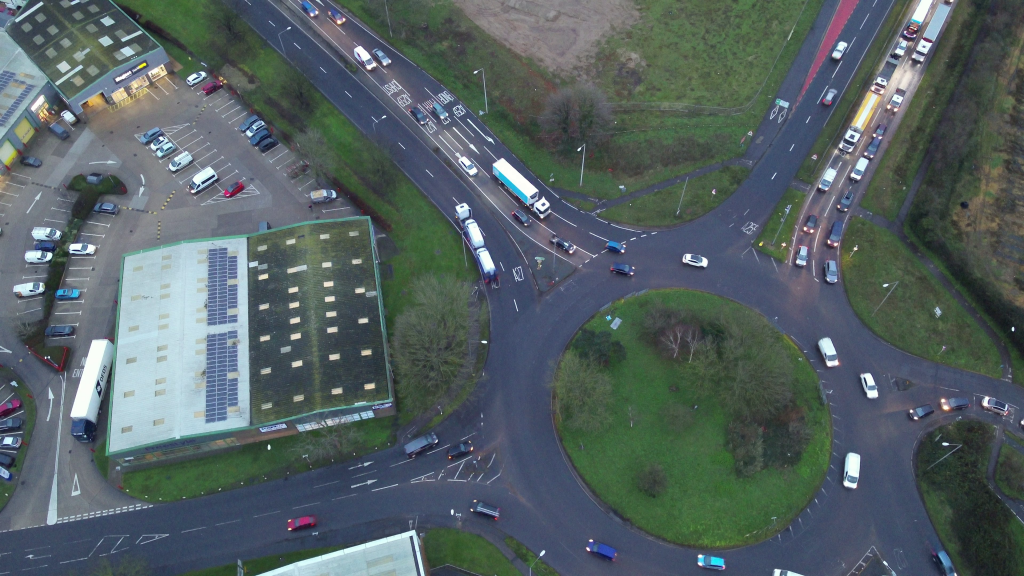
Discover The Drone Ranger’s expert Drone Traffic Survey Service, combining aerial and ground technology to deliver precise traffic data that supports your project goals.
Using the Latest Drone technology, we are capable of filming in difficult conditions including strong winds & rain that lesser drones are not capable off. Ensuring we will hit your important deadlines for Traffic Surveys.
Our setup enables surveys to be conducted without the need for traditional traffic permits, while offering the option to stream live footage to clients on-site throughout the survey.
Culminating in a continuous video of the survey, expertly produced in-house by our Video Editing team and accessible through our advanced file sharing and management system.
Our Process
Discover our detailed approach, guiding you through every phase to maximize the value of our traffic survey services.
Planning
Professional drone surveys start with professional planning. Before every flight, we take time to assess, prepare, and secure everything needed for a smooth, safe, and fully compliant operation.
Click to read more…
Safety is at the core of our operations. We conduct thorough risk assessments tailored to each site and project, identifying potential hazards to people, property, and aircraft. This proactive approach helps prevent issues before they arise and ensures every flight meets industry safety standards.
Navigating drone regulations can be complex — but we’ve got it covered. We manage all necessary flight permissions, including coordination with the Civil Aviation Authority (CAA), local air traffic control, and landowners when required. You can trust us to keep your project fully compliant with all legal and airspace regulations.
Every location presents unique challenges, from terrain and weather conditions to nearby structures and restricted zones. We conduct in-depth pre-site analysis using mapping tools, surveys, and local knowledge to optimize flight plans for efficiency and accuracy. This tailored planning ensures we capture exactly what you need — with minimal disruption to your operations.
Powering Performance, Anywhere!
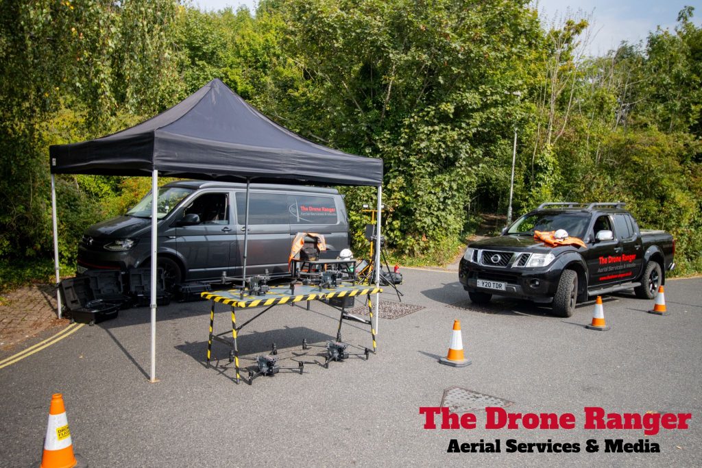
We bring the power — wherever your site is. Our field operations are supported by a smart, adaptable power system that keeps us flying longer and for as long as the Survey is required.
Click to read more…
Our mobile charging stations use a combination of petrol generators, silent power stations, and solar panels, ensuring we’re ready for any environment — remote, urban, or off-grid. Whether you need surveys in a city centre or deep in rural countryside, we bring a reliable energy source with us.
When conditions allow, solar panels supplement our power system, reducing fuel dependency and supporting sustainable operations. It’s our way of delivering greener services without compromising reliability or speed.
The Matrice M30 features intelligent battery management that enables rapid charging, auto-cooling, and predictive power monitoring. This minimizes turnaround time between flights and keeps operations running smoothly, even during long survey days.
All-Weather Capabilties
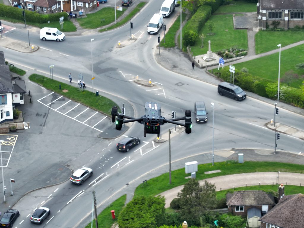
Rain or shine, we keep your project on schedule. Our fleet includes cutting-edge drones desgined for performance in tough environments where others might ground or postpone operations.
Click to read more…
Using advanced drones like Matrice M30 feature an IP55 weather resistance rating, meaning it’s built to handle rain, dust, and challenging conditions without compromising safety or data quality. Where standard drones might be grounded, ours keep flying — reducing costly delays for your project. Withstanding winds up to 15 m/s and functioning in temperatures from -20°C to 50°C, the M30 is engineered for resilience. Whether it’s a misty morning, sudden drizzle, or a gusty site, we’re equipped to adapt and continue capturing the data you need.

Video Editing
Our video editing service transforms raw aerial footage into a seamless, polished single video —ensuring every moment flows smoothly while delivering the insights you need.
Click to read more…
We specialise in editing drone-based traffic survey footage to create a continuous, interruption-free video that maintains full visual clarity. Whether your survey spans a few minutes or numerous hours, we ensure that every transition is handled with care so the viewer experiences an unbroken perspective of the surveyed area.
To add clarity and professionalism, we can integrate custom on-screen elements such as time and date stamps, and your company’s branding and logo. These optional heads-up display (HUD) features make it easier to analyse traffic flow while keeping the presentation consistent with your project’s needs. The result is a highly professional, ready-to-share video that supports both technical review and client presentations.
Publication & File Sharing
Secure, simple, and reliable—our file sharing service ensures your survey footage and media are always accessible when you need them. Whether it’s raw captures or final edited videos, we make storing and sharing your data effortless.
Click to read more…
We store your footage for as long as necessary, giving you peace of mind that your data is safe and ready to access whenever required. Whether you need the media in a large, high-resolution file or compressed versions, we provide the flexibility to suit your workflow.
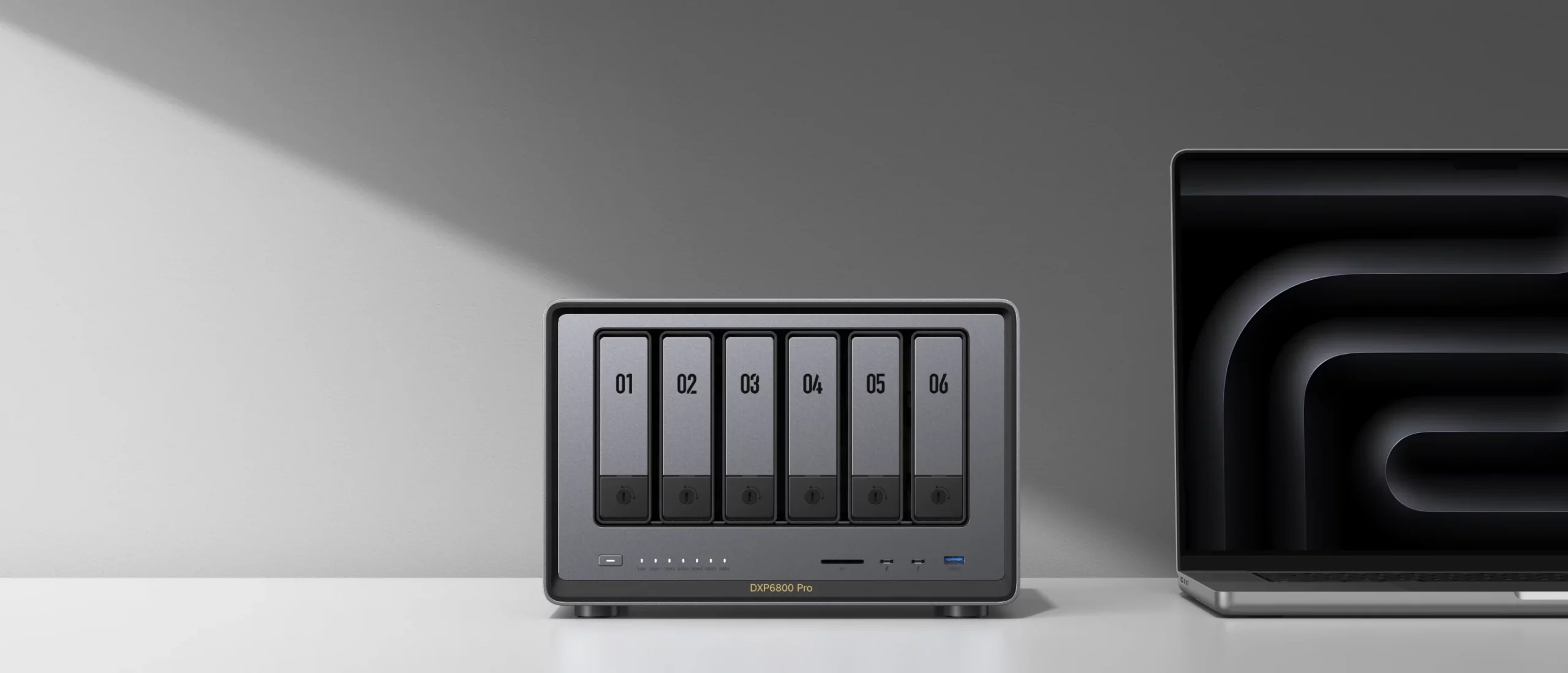
Using our own high-performance NAS (Network Attached Storage) system, we generate secure links that remain active for the duration of your project—or longer if needed. This means you can share content with clients, colleagues, or stakeholders without worrying about expiring links or third-party file size limits.
A NAS-based system also offers several advantages: centralised storage for all project files, enhanced security with controlled access, faster transfer speeds than cloud-only solutions, and the ability to handle multiple large transfers simultaneously. Allowing for the perfect blend of convenience, reliability, and professional-grade data management.